Construction Drone Photography: Building from Above
*We may earn a commission for purchases made using our links. Please see our disclosure to learn more.
Construction Drone Photography: Elevating Project Monitoring and Marketing
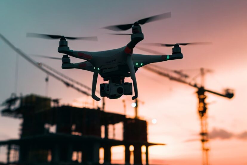
Drones have revolutionized the way we capture images and data, particularly in the construction industry. As a professional in the field, my experience with construction drone photography has demonstrated how these versatile aerial tools provide invaluable perspectives that are not just visually appealing but are critical for informed decision-making. By taking to the skies, drones offer a comprehensive overview of construction sites, enabling precise mapping, progress tracking, and enhanced site analysis.

The utilization of aerial photography in construction has become a standard practice, allowing for a level of detail and breadth that ground-based observation simply cannot match. Employing drones, I am able to rapidly gather topographical data, monitor developments in real time, and ensure that projects align with their designated plans. This aerial vantage point also gives me the ability to identify potential hazards and inefficiencies, leading to improvements in both safety and project management.
Through my utilization of construction drone photography, the breadth of data and imagery collected is astounding. These range from high-resolution photos to comprehensive videos that provide a bird’s eye view of the construction progress. The level of detail captured facilitates better communication with project stakeholders, providing them with a clear picture of where a project stands at any given point in time. It’s a tool that has become essential in the modern construction toolkit, transforming the way projects are documented and managed from inception to completion.
Essentials of Construction Drone Photography

In construction drone photography, my focus lies on selecting the optimal hardware and understanding the regulatory framework critical to safe and legal operations.
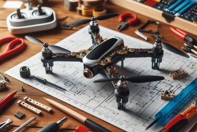
Drone Hardware and Camera Specifications
I carefully consider the drone hardware, keeping an eye on weight and stability. High-resolution cameras are essential for capturing detailed images required in construction projects. A reliable drone setup should include:
- Drone Model: Stability and durability are key.
- Camera Specs: Should support resolutions of at least 4K.
- Weight Capacity: The drone must be able to carry the camera system effectively.
- Battery Life: Longer flight times result in more comprehensive coverage.
Here’s a breakdown of the core elements:
| Component | Description |
| Drone Model | Must be robust and able to withstand construction site conditions. |
| Camera | A camera that offers a minimum of 20 megapixels and can capture in RAW format for the highest image quality. |
| Weight | The drone must hit a balance between being lightweight for agility and heavy enough for stability in various conditions. |
| Battery | A high-capacity battery ensures extended operational time for larger sites. |
Understanding Aviation Regulations
I navigate aviation regulations meticulously to ensure compliance. It’s imperative to understand:
- Local Aviation Laws: These can vary widely by region and govern where and when drones can fly.
- Project-Specific Permissions: Some construction sites may be close to restricted airspace, requiring additional clearances.
- Safety Protocols: These are non-negotiable and include maintaining visual line of sight and flying below a certain altitude.
I keep updated with the latest aviation regulations that are applicable, including:
- Registration: Ensuring all my drones are registered with the relevant aviation bodies.
- Pilot Certification: Holding a current drone pilot certification is compulsory for commercial operations.
- No-fly Zones: Respecting and observing designated no-fly zones to avoid legal issues and maintain safety.
Compliance with these regulations not only aligns with legal requirements but also promotes the safety and integrity of my aerial construction photography work.
Operational Workflow in Drone Photography

In my experience, the key to maximizing efficiency in drone photography within a construction context lies in meticulous planning and systematic execution. The workflow I’ve established ensures each flight yields high-quality data, contributing to accurate progress monitoring and project management.
Setting Up for Optimal Results
To start, I always ensure my drone equipment is in pristine condition. I follow a pre-flight checklist that includes:
- Battery health check and charging
- Calibration of sensors and GPS
- Inspection of propellers and motors
- Verification of on-board storage availability
- Weather and No-Fly zones assessment
Next, I secure necessary permissions and clearances to fly over the jobsite, as overlooking this step can lead to unnecessary disruptions. With everything set, I then proceed to the flight path coordination.
Flight Path Planning and Scheduling
I dedicate considerable effort to planning the flight path to guarantee comprehensive coverage of the construction site. I use mapping software to outline the area and set waypoints that allow me to capture consistent angles and elevations for repeat photography, crucial for progress monitoring.
When it comes to scheduling, I am attentive to several factors:
| Factor | Consideration |
| Time of day | I aim for uniform lighting conditions, often during the golden hour, for the best image quality. |
| Construction phase | I schedule flights to capture essential stages of development without interfering with operations. |
| Data needs | I align the flight schedule with the data reporting cycle to ensure timely delivery of insights. |
By adhering to this structured operational workflow, I maintain efficiency and deliver meaningful data that helps keep the construction project on track.
Applications in Construction Projects

In my experience, the integration of drones into construction projects has revolutionized traditional methods, allowing for more precise and efficient processes in site mapping, progress tracking, and structure inspection.
Site Mapping and Surveying
I’ve observed that drones dramatically enhance the accuracy and speed of topographic mapping and land surveys. They provide:
- High-resolution aerial images: Essential for creating detailed topographic maps.
- 3D site mapping: Enables the development of elevation maps and digital terrain models (DTMs).
This technology facilitates thorough planning and can significantly reduce the time taken to survey a construction site compared to traditional ground-based methods.
Progress Tracking and Reporting
From my dealings, I’ve noticed that drones offer an unparalleled perspective that is vital for:
- Real-time progress tracking: Quick capture of site conditions to monitor construction progress.
- Detailed progress reports: Drones collect data that can be used to generate regular update packages, illustrating changes over time with before-and-after visuals.
These reports help stakeholders stay informed and make well-founded decisions based on the latest site conditions.
Structure Inspection and 3D Modeling
My engagements with drones in the industry have shown me their crucial role in:
- Structure Inspection: Detailed inspection of hard-to-reach areas, reducing the need for physical scaffolding and improving safety.
- Creation of 3D models: Drones are instrumental in developing 3D representations of structures, which are used for planning, design validation, and identifying potential issues before they escalate.
This not only helps in maintaining the integrity of the construction project but also in ensuring adherence to design specifications and regulations.
Data Management and Analysis

In my experience, effective data management and analysis in construction drone photography streamlines project tracking and delivers actionable insights. The key lies in integrating sophisticated software and analytics to translate high-resolution images into progress updates.
Leveraging Software for Data Interpretation
I use advanced photogrammetry software, such as DroneDeploy, to interpret the raw aerial imagery captured by drones. This software excels at stitching together images to create detailed 3D maps and models. To ensure accuracy, ground control points (GCPs) are vital. They serve as reference points and are essential for geo-referencing my data which leads to precise measurements and analysis.
- Step 1: Collect high-resolution images using a drone equipped with a suitable camera.
- Step 2: Upload images to the photogrammetry software.
- Step 3: Apply GCPs to enhance accuracy.
By meticulously following these steps, I am able to manage large datasets efficiently and generate comprehensive site models.
Analytics and Progress Updates
For analytics, I rely on the same software’s analytical tools to monitor changes over time. This enables me to provide regular progress updates, which are fundamental for project management.
- Frequency of Updates: I analyze and compile reports on a weekly or bi-monthly basis, depending on project requirements.
- Key Metrics: I focus on metrics like volume calculations, change detection, and project timeline adherence.
Through detailed analytics, I can identify potential issues early, allowing for proactive management decisions. This process not only ensures that stakeholders are kept informed with the latest progress but also that the data supports efficient decision-making.
Enhancing Communication with Stakeholders

In my experience, drone photography has revolutionized how I communicate with stakeholders involved in a construction project. I provide detailed visual documentation, allowing for greater clarity and comprehensive oversight.
Custom Reports and Visual Aids
Customizing reports with drone photography is integral to my process. By incorporating aerial footage into my updates, I create visual aids that convey the progress of construction in a way that is both clear to interpret and visually compelling. Panoramic images and video capture from drones offer a bird’s-eye view that I use to outline project milestones, clearly showing completed phases and future steps.
These tailored reports help stakeholders better understand the current status and next phases of the project from their unique perspective.
Nationwide Collaboration and Sharing
My role often involves fostering collaboration between various stakeholders who might be geographically dispersed across the country. Using drone photography, I compile high-resolution imagery and dynamic video snippets that can be shared on nationwide platforms, ensuring that all parties, regardless of their location, have access to the latest updates. I create secure online galleries or cloud-based portfolios where general contractors and clients can view panoramic sequences or zoom into specific details of their project from anywhere in the nation. This method promotes a transparent environment that reflects my dedication to open communication and project integrity.
Frequently Asked Questions
In this section, I’ll provide insight into some of the most common questions regarding construction drone photography, focusing on its benefits, project reporting enhancement, service provider qualifications, image processing software, legal aspects, and safety considerations.
1. What are the benefits of using drones for construction site monitoring?
Drones offer comprehensive situational awareness for construction sites. I find that this aerial perspective is vital for tasks such as site mapping and progress monitoring, which help in project planning and safety inspections.
2. How does drone photography enhance construction project reporting?
Drone photography provides high-resolution imagery that can document construction progress in real time. I believe this improves communication among stakeholders, allowing for a more transparent and accurate representation of the construction phase.
3. What qualifications should I look for in a construction drone photography service provider?
When selecting a drone photography service provider, I ensure they have certified pilots with experience in construction environments. It’s also essential that they have the right insurance and adhere to industry standards for safety and quality.
4. Which software is recommended for processing construction site drone imagery?
For processing drone imagery, I recommend software that offers features like photogrammetry, 3D modeling, and volume measurements. Software that integrates with GIS platforms is particularly valuable for in-depth analysis and project management.
5. Are there legal considerations to be aware of when utilizing drone photography in construction?
Yes, while utilizing drone photography in construction, I am aware of regulations surrounding airspace, privacy, and commercial drone operations. Compliance with Federal Aviation Administration (FAA) rules and obtaining necessary permits is critical.
6. What safety measures need to be implemented during construction drone operations?
Safety measures for drone operations include conducting pre-flight checks, maintaining visual line of sight, and being aware of weather conditions. I make sure to follow these protocols to minimize the risk of accidents and ensure the safety of both site personnel and equipment.