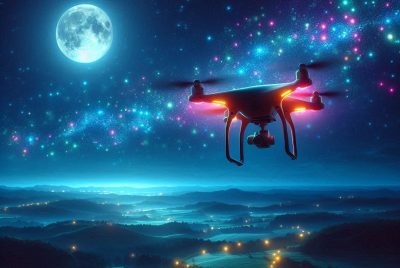
Drone Photogrammetry: Mapping the Future from Above
*We may earn a commission for purchases made using our links. Please see our disclosure to learn more.
Drone Photogrammetry: Advancing Precision in Mapping and Surveying
Drone photogrammetry harnesses the capabilities of modern drones to capture high-quality images which are then used to create precise 3D models and maps. As an advanced application of photogrammetry, which is the science of making measurements from photographs, this technique extends its utility beyond traditional methods. Utilizing drones for photogrammetry has multiple advantages; it improves accuracy, enhances efficiency, and elevates safety, especially in industries that require detailed geographical data, such as construction, agriculture, and civil engineering.
My exploration into the uses of drone photogrammetry reveals a technology that is transforming industry practices. It has become invaluable in real estate and filmmaking, where capturing every contour of the landscape or property can make a significant difference in planning and presentation. The process involves the collection of aerial imagery from different perspectives, which is then processed to create detailed 3D or 4D models.
The benefits of employing drones for photogrammetric purposes are evident in the outcomes. From reducing the time spent gathering data to enabling access to previously hard-to-reach areas, drone photogrammetry offers a level of detail and convenience that ground surveys cannot match. This adaptability makes it an essential tool in my array of techniques for accurate terrain analysis and data collection.
Fundamentals of Photogrammetry

Before delving into drone and traditional photogrammetry methods, it’s essential for me to clarify the core principles that define photogrammetry. This will provide a foundation for understanding its broader applications and the advantages of drone-assisted techniques.
Understanding Photogrammetry
Photogrammetry is a science and technology that I identify for acquiring reliable information about physical objects and the environment through a process of recording, measuring, and interpreting photographic images and patterns of electromagnetic radiant imagery and other phenomena. When I speak of 3D photogrammetry, it is the process where I use two-dimensional images to create three-dimensional models. This process can be divided into aerial photogrammetry, where images are captured from an aerial vehicle such as an airplane or a drone, and terrestrial photogrammetry, which uses images taken from the ground. The basics of photogrammetry involve taking overlapping images at various angles, which software then stitches together to create an accurate 3D representation.
| Photogrammetry Type | Image Acquisition | Common Applications |
| Aerial | Aircraft or drone | Mapping, agriculture |
| Terrestrial | Camera on tripod | Architecture, archaeology |
Drone Photogrammetry Versus Traditional Methods
When I compare drone photogrammetry to traditional methods, several key differences stand out. Traditional aerial photogrammetry typically requires piloted aircraft and can be more time-consuming and expensive. Drones, on the other hand, offer a more accessible and flexible method to capture images, particularly useful for smaller or more difficult-to-reach areas. They can hover and maneuver in ways that are simply not possible for manned aircraft. The fact that drones can fly at lower altitudes results in higher-resolution images, which is integral for detailed modeling and analysis. My assessment is that for many applications, drone photogrammetry is not only more cost-effective but also provides an enhanced level of precision and accessibility, which is reflected in the rapid growth of the drone data services market.
| Aspect | Drone Photogrammetry | Traditional Methods |
| Cost | Generally lower | Higher, requires aircraft |
| Precision | High-resolution images | Limited by altitude |
| Accessibility | Flexible, can access restricted areas | More restrictions |
| Time Efficiency | Faster deployment and data capture | More time-consuming |
By understanding the fundamentals of photogrammetry and differentiating between drone and traditional methods, I have a solid base for exploring practical applications in various fields, ranging from environmental studies to urban planning.
Technical Aspects of Drone Photogrammetry

In my experience, capturing high-precision data through drone photogrammetry entails a comprehensive understanding of the equipment and software, rigorous calibration, and meticulous data processing techniques. This attention to detail ensures the accuracy and reliability of the final output.
Equipment and Software
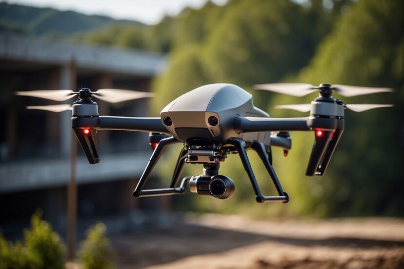
Drones: For photogrammetric applications, I recommend drones with strong GPS capabilities, like the DJI Matrice 300 RTK, which offers a stable platform for the necessary tasks. The UAV should support integration with high-resolution cameras such as the Zenmuse P1, designed specifically for advanced mapping and surveying.
Cameras: Opt for cameras that provide sharp, distortion-free images. Sensor size and lens quality factor significantly into the accuracy of photogrammetric models.
Photogrammetry Software: After collecting imagery, photogrammetry software like Pix4D, DroneDeploy, or Agisoft Metashape plays a pivotal role. They convert images into 2D or 3D models. Among them, I’ve found Pix4D to be exceptionally user-friendly and quite robust in processing aerial data.
Calibration and Settings
For optimal results, calibration of the equipment is crucial. Ensure that the camera’s intrinsic parameters (like focal length and lens distortion) and the drone’s extrinsic parameters (like its position and orientation) are finely tuned.
GPS Calibration: A high-quality GPS system provides geo-referencing for images with precise location data. This augmentation is vital for accurate mapping.
Camera Settings: I always set my camera to manual mode to maintain consistent exposure and focus across all images. Overlapping images by at least 60% horizontally and 30% vertically is necessary to ensure coverage and accuracy.
Data Processing Techniques
When processing the data, accuracy is paramount.
- Alignment: Start with aligning the aerial images, ensuring each picture is accurately placed according to its GPS coordinates.
- Point Cloud Generation: Generate a dense point cloud where each point represents a precise location in the physical space.
- 3D Modeling: For creating 3D models, employ algorithms that can stitch the point cloud data seamlessly, without compromising on the model’s integrity.
- Orthomosaic Maps: Compile the images to form a single, detailed, and accurate orthomosaic map.
In the data processing phase, it’s critical to consider not just the photogrammetry software’s capability, but also the processor and memory capacity of your computer, as these tasks are resource-intensive.
Practical Applications
In this section, I’ll explore how drone photogrammetry serves various industries, enhances surveying and GIS, and monitors construction and infrastructure with unparalleled precision.
Industry-Specific Uses
Industries:
- Mining: I use drones to efficiently map and model mine sites, aiding in calculating volumes, planning blasts, and monitoring safety.
- Forestry: I assist in mapping forest plots to estimate timber volume and assess health, which conserves resources and supports sustainable management.
- Agriculture: By deploying UAVs, I analyze crop health, improve yield predictions, and inform precision agriculture practices.
- Urban Planning: I’m involved in modeling cityscapes to aid in the development planning process, engaging in space optimization and impact assessment.
- Archaeology: I contribute to non-invasive site exploration, preserving delicate historical structures while capturing data for 3D Modeling.
Surveying and GIS Integration
Surveying and GIS: Drone photogrammetry is a vital tool that I use to rapidly collect topographic data, which integrates into GIS platforms. This data assists in:
- Land Management: Making informed decisions about land use and resource management.
- Environmental Studies: Tracking changes in landscapes, helping to assess environmental impacts.
Construction and Infrastructure Monitoring
Construction and Infrastructure: My role includes monitoring construction sites and infrastructure projects. For instance:
- Progress Tracking: I deliver real-time insights on project advancement to stakeholders.
- Quality Assurance: I identify potential issues before they become costly problems.
- Maintenance: I support infrastructure maintenance by spotting wear or damage over time.
By employing drones, I assist in ensuring that construction projects adhere to plans and timelines. Drone photogrammetry not only saves time and reduces costs but also increases safety by minimizing the need for personnel in hazardous areas.
Real-World Considerations

In leveraging drones for photogrammetry, I must be mindful of safety protocols and environmental factors that significantly affect data quality. These considerations help ensure efficient and effective operations.
Safety and Regulations
As a drone pilot, I prioritize safety and compliance with regulations which govern aspects such as:
- Flight height restrictions: I adhere to altitude limitations to avoid collisions with manned aircraft.
- No-fly zones: I am careful to avoid restricted areas like airports and military bases.
- Pilot certification: I ensure my certifications are current, demonstrating my knowledge of aeronautics and regulations.
- Safety checks: Before each flight, I perform equipment checks to prevent malfunctions mid-air.
Environmental Influence on Data Collection
Data collection via remote sensing is susceptible to environmental variables that can affect the accuracy and quality of my photogrammetric models.
- Weather conditions: I schedule flights during clear weather to limit distortions caused by precipitation and to optimize lighting.
- Wind impact: Strong winds can cause stability issues, which might lead to blurred images or inaccurate data, so I monitor forecasts.
- Lens distortion: This is mitigated through careful calibration to ensure precise measurements.
- Erosion: When studying changing environments, specifically erosion, I take multiple snapshots over time to capture the extent and impact accurately.
Advancing Drone Photogrammetry
In the rapidly evolving field of drone photogrammetry, I’ve observed that the integration of new technologies and the anticipation of future developments are central to expanding its applications and accuracy.
Emerging Technologies in Photogrammetry
One notable technological advancement I’ve seen is the incorporation of Real-Time Kinematic (RTK) positioning, which enhances the precision of geotagging data captured by drones. This is especially significant when paired with high-end drones like the DJI Matrice 300 RTK and state-of-the-art cameras such as the Zenmuse P1. The synergy between these tools results in impressive flight times of up to 55 minutes, allowing for extensive data collection in fields like agriculture and environmental studies.
Another advancement is in the realm of sensors. The use of LiDAR (Light Detection and Ranging) technology has become more prevalent, enabling users to create detailed three-dimensional representations of surveyed terrains. Multispectral and thermal sensors are also increasingly common, offering insights into crop health and energy efficiency that were previously difficult to obtain.
| Technology | Benefits |
| RTK Positioning | Improved geotagging accuracy |
| LiDAR | 3D terrain modeling |
| Multispectral | Agricultural applications |
| Thermal Imaging | Energy efficiency analysis |
Future Trends and Developments
Looking ahead, I anticipate that the integration of drone photogrammetry with data from satellites will enhance the scope and veracity of spatial analysis. This convergence could lead to a continuous stream of information, reducing the need for repeated manual surveys.
In terms of hardware, companies like DJI and Intel are at the forefront, driving innovation within the industry. DJI drones are becoming more versatile and user-friendly, while Intel is pushing the boundaries with advanced computing capabilities. I expect advancements led by these companies to broaden the utility of drones in photogrammetry, particularly through enhanced autonomy and improved sensor quality.
Post-Processed Kinematic (PPK) workflow might also see more adoption, allowing for increased flexibility in data capture and processing times. This technique can be especially effective in areas where maintaining consistent RTK signal quality is challenging.
In summary, the field of drone photogrammetry is on a trajectory of significant technological growth, underpinned by pioneering innovations and the promise of future developments that aim to optimize accuracy and expand the potential for comprehensive spatial analysis.
Frequently Asked Questions
In this section, I’ll address common inquiries about drone photogrammetry, aiming to clarify the specifics of software, career paths, educational requirements, salary expectations, equipment comparisons, and technology distinctions in mapping and surveying.
1. What software is recommended for drone photogrammetry?
For drone photogrammetry, software like Agisoft Metashape, Pix4Dmapper, and Autodesk ReCap are highly recommended. These powerful options support a range of photogrammetric tasks, including 3D reconstruction and mapping with precision.
2. How can someone pursue a career in drone photogrammetry?
To pursue a career in drone photogrammetry, you should focus on gaining a strong background in subjects like remote sensing, GIS (Geographic Information Systems), and UAV (Unmanned Aerial Vehicle) technology. Many professionals also benefit from having certifications specific to drone operation and photogrammetry.
3. What are the prerequisites for enrolling in a drone photogrammetry course?
Prerequisites typically include a basic understanding of UAVs, GIS, and sometimes a background in surveying or a related field. Familiarity with drone operation and regulations is often essential before taking an advanced course in drone photogrammetry.
4. What are the typical salary ranges for professionals in the drone photogrammetry industry?
Salaries in drone photogrammetry vary based on experience and location, but entry-level positions may start from $40,000 to $50,000 per year, while experienced professionals can earn upwards of $70,000 or more annually.
5. How do DJI drones compare to others in terms of photogrammetry accuracy?
DJI drones, such as the DJI Matrice 300 RTK with Zenmuse P1 camera, are known for their high accuracy and are considered top-tier in drone photogrammetry. They are well-regarded for integrating advanced flight features with state-of-the-art camera technology, delivering high precision data across various industries.