Real Estate Drone Photography: Aerial Perspectives
*We may earn a commission for purchases made using our links. Please see our disclosure to learn more.
Real Estate Drone Photography: Elevating Property Marketing to New Heights
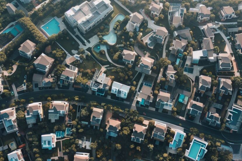
In the competitive world of real estate, showcasing properties effectively is crucial for success. Drone photography has emerged as a powerful tool in this regard, allowing real estate professionals to capture compelling aerial imagery that highlights the scale, context, and beauty of a property. These images can provide potential buyers with a unique vantage point, delivering a comprehensive understanding of the property and its surroundings.

Employing drones for real estate photography not only adds value by offering panoramic and perspective-rich views but also speeds up the process of obtaining high-quality images of hard-to-reach areas. It’s essential for real estate marketers to understand the technical aspects, such as the selection of the right drone, understanding the legal requirements, and developing the necessary piloting skills to ensure the imagery produced is both stunning and effective in driving sales.
As someone who has seen the impact of drone photography in real estate firsthand, I can say that it’s more than just a trend; it’s a transformative approach that has redefined property marketing. Ensuring adherence to FAA regulations is imperative for legal operations, and obtaining the appropriate licensing is part of the process, which contributes to the safety and professionalism of the industry.
Benefits of Real Estate Drone Photography

Real estate drone photography offers significant advantages over traditional ground-based photography.
Enhanced Perspective
With my drone, I can capture unique aerial views that showcase the entirety of a property, its layout, and its boundaries. Potential buyers get a comprehensive picture from angles they wouldn’t otherwise see.
Standout Listings
Homes with drone images often attract more attention. My listings with high-resolution aerial shots tend to draw in more potential buyers, as they make the property stand out from others that only have standard photos.
Highlighting Features
If a property has notable features like a large garden, a pool, or proximity to beautiful landscapes, I use my drone to highlight these attractive points.
Efficiency and Accessibility
Drone photography allows me to quickly photograph a property from multiple angles, saving time and resources. This efficiency translates to faster listings and a quicker sales process.
Cost-Effectiveness
Before drones, aerial shots were prohibitively expensive, involving helicopters or small planes. Now, I can provide premium views at a fraction of the cost.
Technical Excellence
Modern drones feature high-quality cameras with 12MP or higher resolution and 4K video capability. These specs ensure that the imagery I provide my clients is clear and engaging.
By integrating drone photography into my real estate marketing, I effectively showcase properties, which leads to increased interest and potentially faster sales.
Best Practices for Drone Photography

In my experience, mastering a few core principles can significantly enhance the quality and impact of real estate drone photography. Below, I’ll detail crucial strategies for excelling in this field, from meticulous flight planning to ensuring legal compliance.
Flight Planning
Before I take flight, I meticulously plan my drone’s route. I use mapping software to predetermine points of interest and determine the best angles for property shots. I always ensure my flight path avoids obstacles and respects privacy.
- Objectives: Establish clear goals for each flight session.
- Pre-flight checks: Confirm battery levels, signal strength, and propeller integrity.
- Flight path: Use apps to chart a route, highlighting areas to capture.
Camera Settings and Equipment
I choose my equipment carefully, ensuring I have a drone with a high-resolution camera that captures at least 12MP images and 4K video. The gimbal stabilization is non-negotiable for sharp, clear images. I set the camera to a low ISO for crisp photos and adjust the shutter speed according to the lighting conditions.
- Resolution: Aim for drones that support 12MP for images and at least 4K for video.
- Stabilization: Ensure gimbal support for steady shots.
- Manual Settings: Set ISO, aperture, and shutter speed for optimal exposure.
Weather and Timing
I capture the best lighting and minimal shadows by scheduling shoots during the golden hours, just after sunrise or before sunset. I always check the weather forecast ahead of time and avoid windy or inclement weather conditions that could affect the drone’s stability and image quality.
- Golden Hours: Schedule shoots early morning or late afternoon.
- Weather Check: Avoid rain, strong winds, or disruptive weather patterns.
Legal Considerations
I stay informed about the latest FAA regulations and ensure I have the necessary waivers for commercial drone flights. I respect privacy laws and never capture images of neighboring properties without consent. Flying within legal altitude limits is crucial to avoid penalties.
- FAA Compliance: Follow all guidelines for commercial drone use.
- Privacy: Obtain consent before capturing adjacent properties.
- Altitude: Adhere to the maximum legal altitude limits.
Editing and Post-Production Techniques

In real estate drone photography, post-production is where the magic happens. I would like to emphasize the importance of color correction as a starting point. This ensures that the images accurately represent the property, maintaining color balance and consistency across shots.
Exposure Adjustment:
- Balance highlights and shadows
- Bring out details often lost in darker areas
White Balance:
- Correct color casts
- Maintain color temperature alignment with the scene’s natural lighting
Noise Reduction:
- Smooth out pixels in low-light conditions
- Preserve image clarity without over-processing
I also implement sharpening techniques to enhance the clarity of the images. However, I do it sparingly to avoid creating an unnatural look.
As for the actual workflow, I follow this sequence:
- Import and sort images
- Apply lens corrections to counteract distortion
- Adjust tone and exposure
- Work on color grading
- Refine with localized edits (brushes, gradients)
- Sharpen and reduce noise
- Export with optimized settings for the intended platform
To streamline the process, I often sync adjustments across images taken under similar conditions. This saves time and maintains consistency.
Finally, I groom the footage for presentation. Ensuring smooth transitions in video clips and adding background music that complements the visual content often makes a significant difference in engaging potential buyers. It’s important that these elements do not overshadow the property itself but rather elevate the presentation to a professional level.
Marketing Strategies for Drone Photographs
Effective marketing strategies are critical for showcasing drone photographs to potential clients in the real estate sector. My focus is to utilize established platforms and social media to effectively promote this unique perspective of properties.
Listing Platforms
I always ensure that my drone photographs are prominently featured on popular real estate listing platforms. Here’s how I maximize their impact:
- Quality Over Quantity: I select only the most striking images that highlight the property’s best features, ensuring each photo is high-resolution and professionally edited.
- Detailed Descriptions: Each photograph includes a concise description, focusing on the elements that make the property stand out.
- Logical Sequencing: I arrange photos in a logical order to create a virtual tour experience, starting with a stunning aerial shot to capture attention.
Social Media Promotion
Social media serves as a powerful tool for promoting drone photographs. Here’s my approach to leveraging these platforms:
- Platform Choice: I prioritize platforms popular with real estate professionals and potential buyers, such as Instagram and Facebook.
- Regular Posting: Consistency is key. I post content regularly to keep my audience engaged and informed.
- Interaction: I actively engage with my followers, respond to comments, and participate in relevant conversations to increase visibility.
- Hashtags & Tags: Utilizing relevant hashtags and tagging clients or locations can significantly expand my reach.
By combining the broad reach of listing platforms with the interactive nature of social media, I successfully market my drone photography to a diverse audience of real estate professionals and potential buyers.
Emerging Trends in Drone Photography

The landscape of drone photography is rapidly evolving, with new technologies enhancing how I capture real estate imagery. One of the most promising trends is the integration of 3D mapping capabilities. This technology allows me to create detailed three-dimensional models of properties, giving potential buyers a more immersive experience.
Another trend that’s reshaping the field is the use of AI-driven analysis. This advancement aids in processing images and videos to deliver more insightful data about a property. AI algorithms can highlight property features, analyze landscapes, and even estimate property sizes, making information more accessible to clients.
Higher Resolution Cameras are becoming standard, with 6K video capabilities now available in drones such as the Autel Evo Lite+. This ensures crisper, more detailed images that can showcase properties in their best light.
The emergence of compact drones with advanced features has made aerial photography more accessible. Drones like the DJI Mini 3 Pro provide an excellent balance of image quality and affordability, making it easier for me to add aerial shots to my real estate photography services without a significant investment.
Lastly, the improvement in battery life and flight time allows for longer sessions, meaning I can cover more ground without frequent recharging. Some drones currently offer up to 40 minutes of flight time, significantly increasing efficiency during a shoot.
By keeping up with these trends, I ensure that the services I provide remain at the forefront of real estate drone photography.
Frequently Asked Questions
In my experience, clients and colleagues frequently ask about the specifics of real estate drone photography. This section aims to address those common queries.
1. How is real estate drone photography priced?
Pricing for real estate drone photography varies widely. I often base my rates on factors like property size, location, and complexity of the shoot. You can expect to pay anywhere from $100 to $200 for a basic package, but prices can rise significantly for larger properties or more detailed work.
2. What qualifications are needed to become a real estate drone photographer?
As a professional real estate drone photographer, one must possess both technical skill with drones and a keen eye for photography. Additionally, it’s essential to have knowledge of local regulations and obtain the necessary certifications, which typically include passing a federal aviation exam.
3. What are the best drones to use for real estate photography?
The best drones for this line of work combine high-resolution cameras with stable flight capabilities. Drones like the Mavic 2 Pro or the Mavic 3 are excellent choices because of their 20-megapixel sensors and gimbal stabilization, ensuring crisp images and smooth footage of properties.
4. How does one obtain a license for real estate drone photography?
To operate drones legally for commercial purposes, one must obtain a Remote Pilot Certificate from the Federal Aviation Administration (FAA). This process includes passing the Part 107 knowledge test, which covers airspace regulations, operations, and safety procedures.
5. Can real estate drone photography significantly increase property sales?
Yes, by providing an elevated perspective, real estate drone photography can highlight features of a property that might otherwise go unnoticed, creating compelling visual content that can attract greater interest from potential buyers and ultimately contribute to increased property sales.
6. What are typical career opportunities in real estate drone photography?
Career opportunities in this field range from freelance work to in-house positions with real estate firms or marketing agencies. Some drone photographers may specialize in residential properties, while others focus on commercial spaces or land. Advanced expertise could lead to roles in creating virtual tours or consulting on drone technology implementation.